Walk Portland Pilot
Explore our prototype pedestrian wayfinding system!
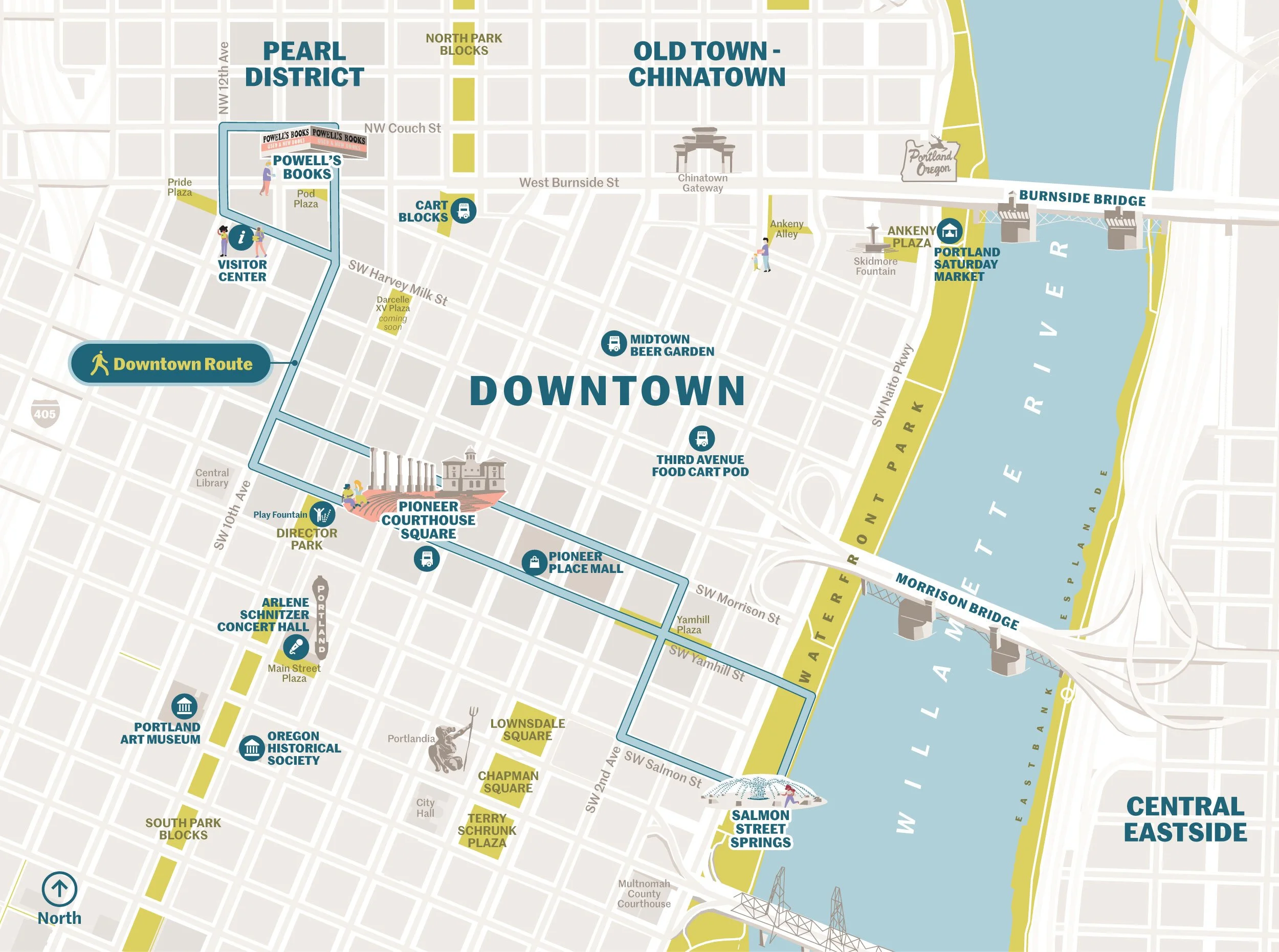
We’re piloting a pedestrian wayfinding system in downtown Portland through October and we want YOU to come check it out. We’re using prototype maps, signs and environmental graphics to explore learnings from our research phase and to study interactions and behaviors. The prototype system comprises a route that connects Powell’s, the Portland Visitor Center, Pioneer Courthouse Square and the waterfront. Check it out next time you’re downtown—or even better—come downtown to check it out. We want to hear your feedback and perspective!
Huge thanks to our amazing clients at Travel Portland and the Portland Bureau of Transportation, as well as our print/fabrication partner PVS Graphics.
Details:
August 4 - October 31
Downtown Portland
Learn more at walkpdx.com and share your feedback via the QR code on the signs themselves.