

Experience Design / Wayfinding / Strategy
The best way to experience Portland is to walk it.
But how do people decide where to go and how to get there? Walk Portland is an initiative by Travel Portland, the Portland Bureau of Transportation (PBOT) and sparks+sullivan to develop a wayfinding system to make it easier for pedestrians—whether from Lents, Tigard, or Tokyo—to explore the heart of the city.

Before designing and installing wayfinding tools, we wanted to connect as a community to find ways to welcome, guide, and help people experience Portland. To envision that future, we grounded ourselves in the present needs that pedestrians face, using human-centered design methods and community engagement strategies.

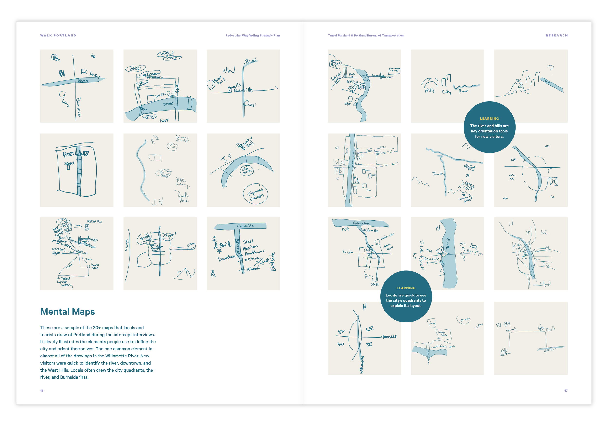

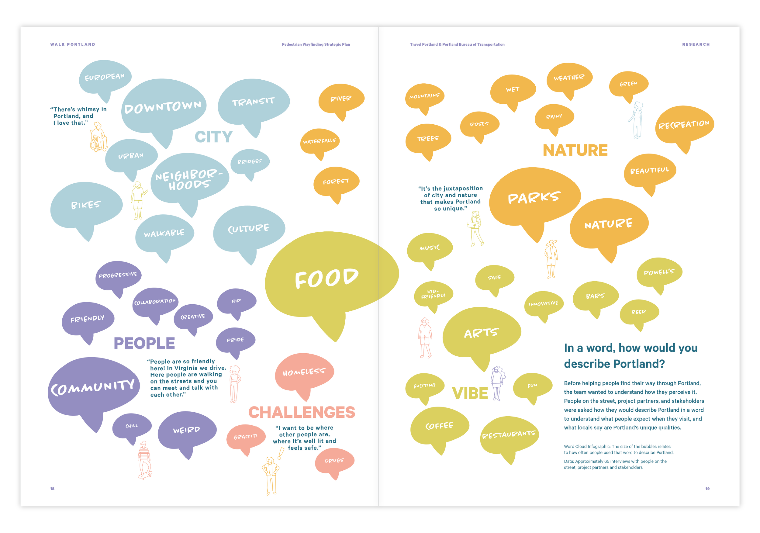
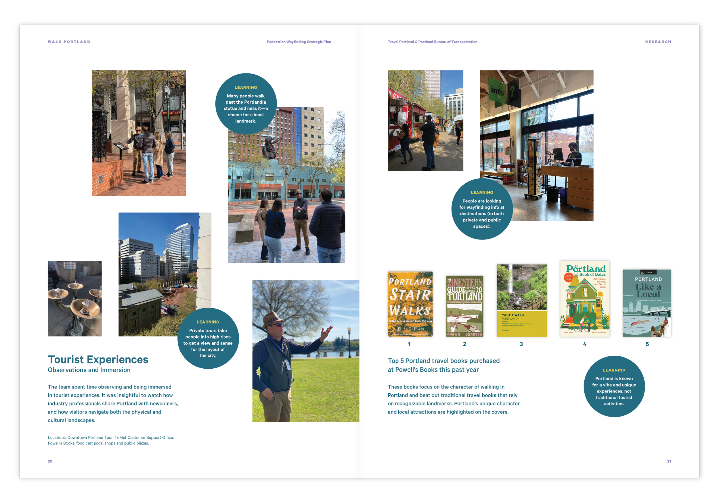
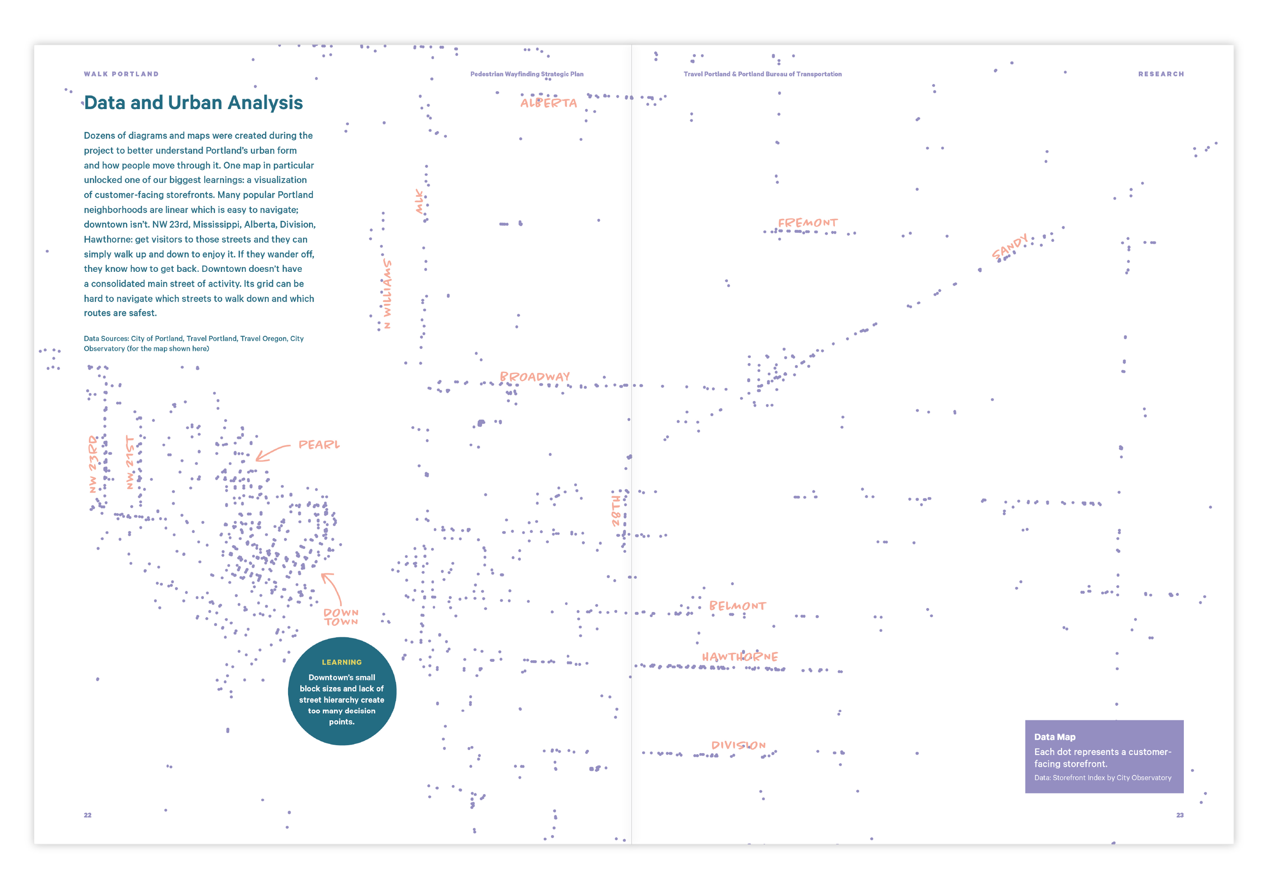
The team used a wide range of methods to better understand how people currently understand Portland, how they find their way through it, and the challenges in building and maintaining wayfinding systems. Speaking with tourists, locals, commuters, and business owners to name a few, the research prioritized methods that invited people to participate and collaborate.

The success of the project depended on both meaningful collaboration and building enthusiasm among stakeholders, partners, and the public. The team made space for stakeholders and the public to contribute to the work by creating an installation that shared the research and values and invited participation. The interactive installation was originally planned for two weeks, and by popular demand was extended to one month.
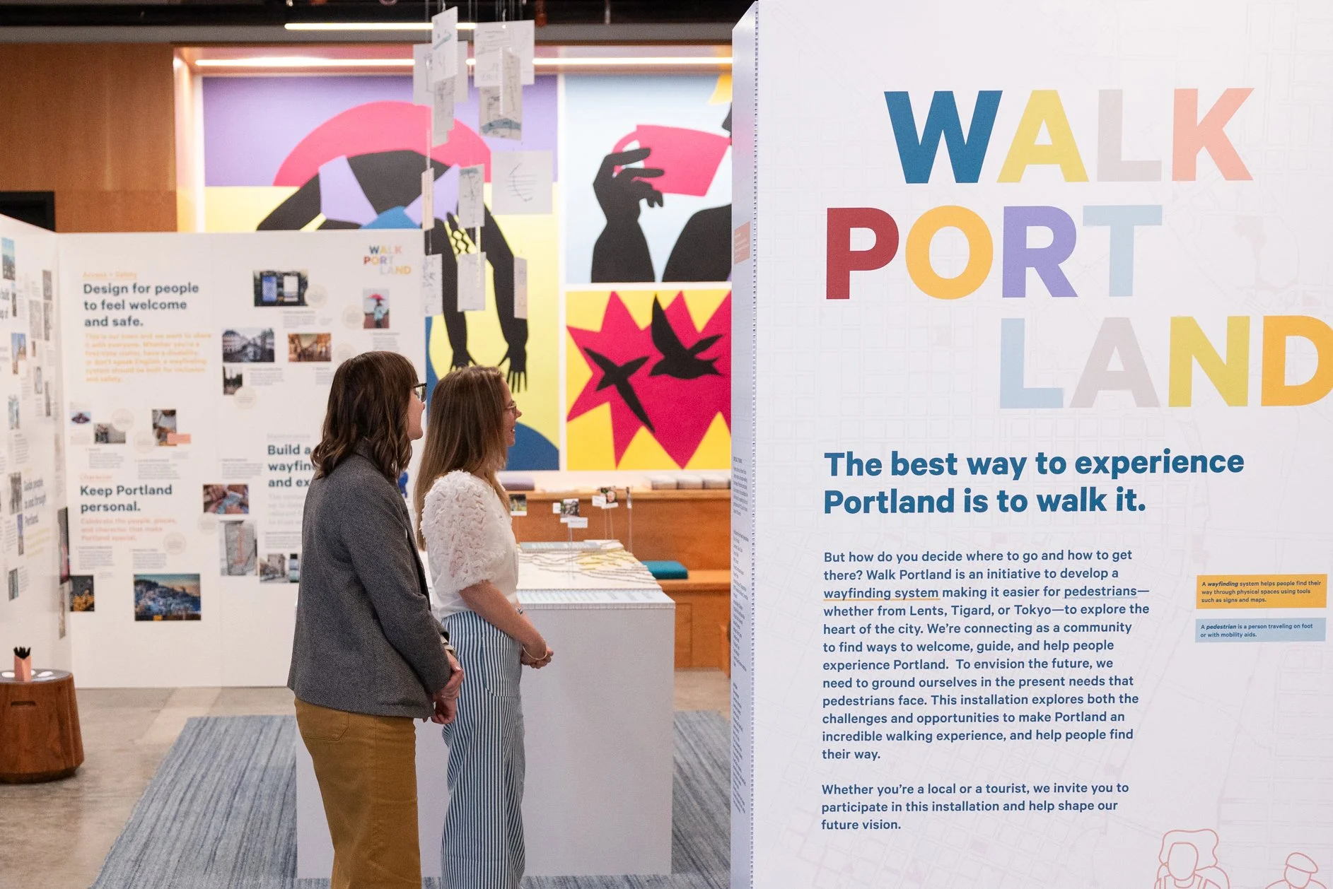

We located the installation in Travel Portland’s visitor center and created a “room” with walls that framed a table-top map and hanging mental maps.
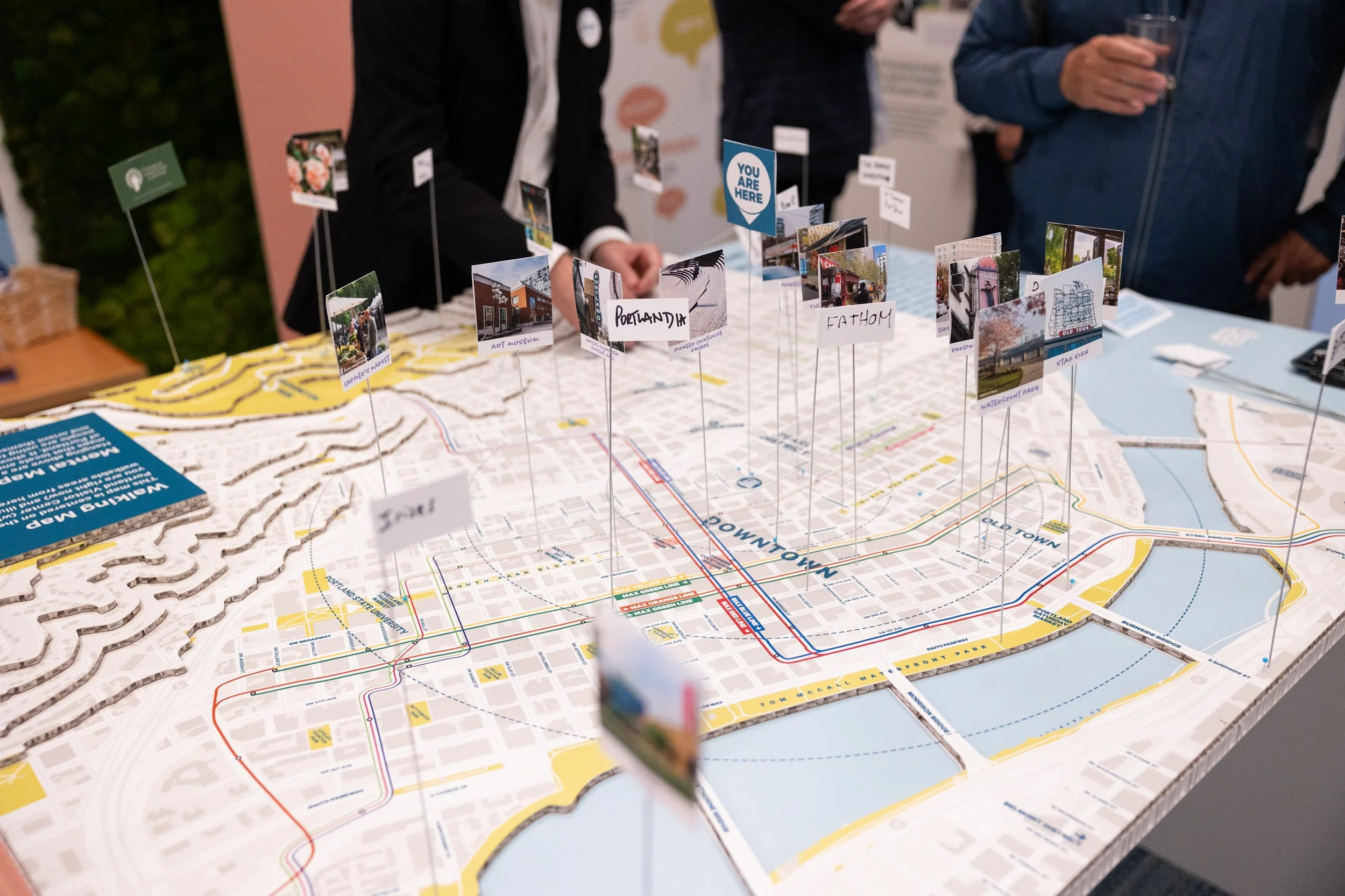
A table-top map of downtown Portland invited people to share their favorite landmarks and destinations.
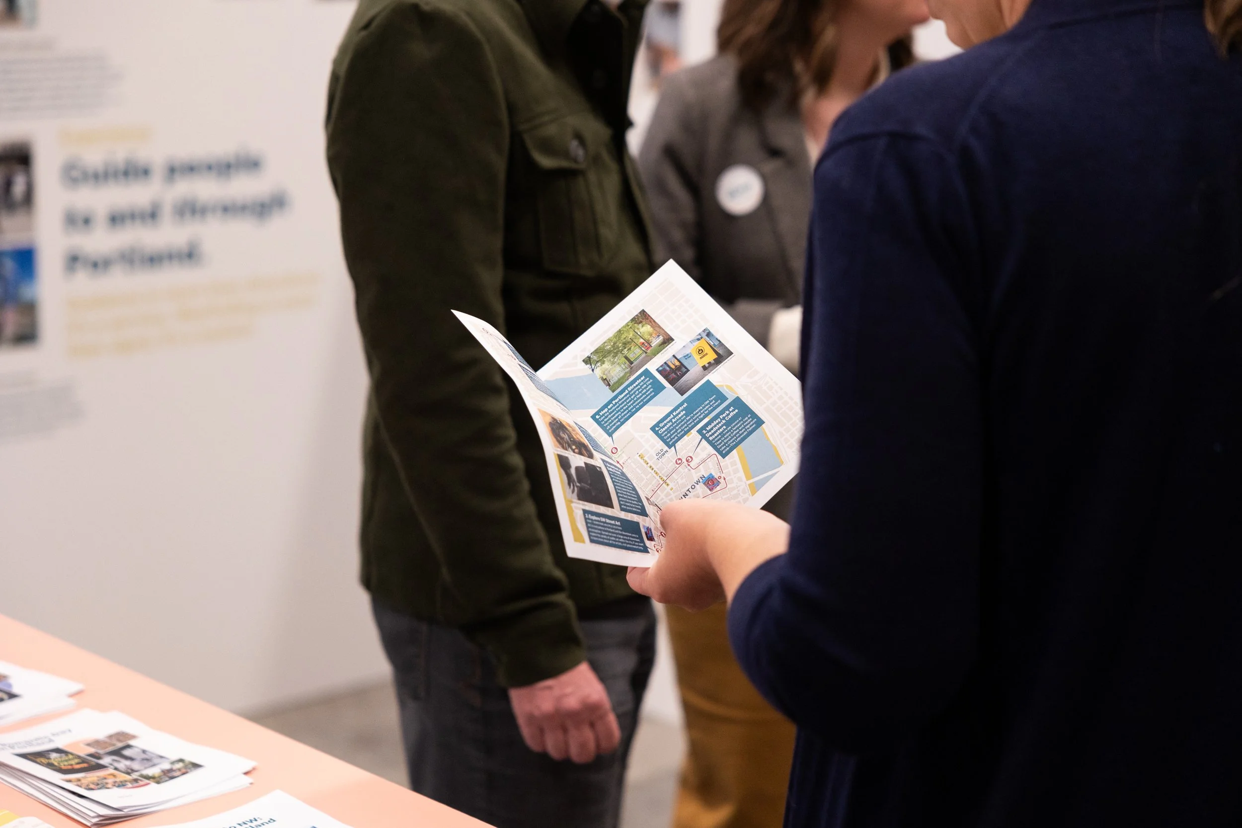
We worked with Visitor Center staff to prototype walking itineraries for downtown Portland.

Mental maps from intercept interviews with pedestrians were hung over the tabletop map, inviting comparisons.

Participants shared their opinions and ideas using post-its, stickers and flags. The final plan integrated their feedback.

People are interested in pedestrian wayfinding and showed an excitement to participate with the exhibit:
2,055 people visited the Visitor Center during the exhibit
12 tours were conducted with city staff teams
60 locations were labeled by participants on the exhibit’s 3D map
82 comments were written on post-its by participants
158 sticker dots or “votes” were added to ideas that people liked
Following the installation, we integrated feedback and developed a strategic plan—in a print book format and “pitch deck.” Using those tools, PBOT and Travel Portland secured a competitive State of Oregon grant to fund a pilot, which debuted in August 2025.


The pilot enabled us to both build on the excitement generated from the installation and test assumptions from our research.
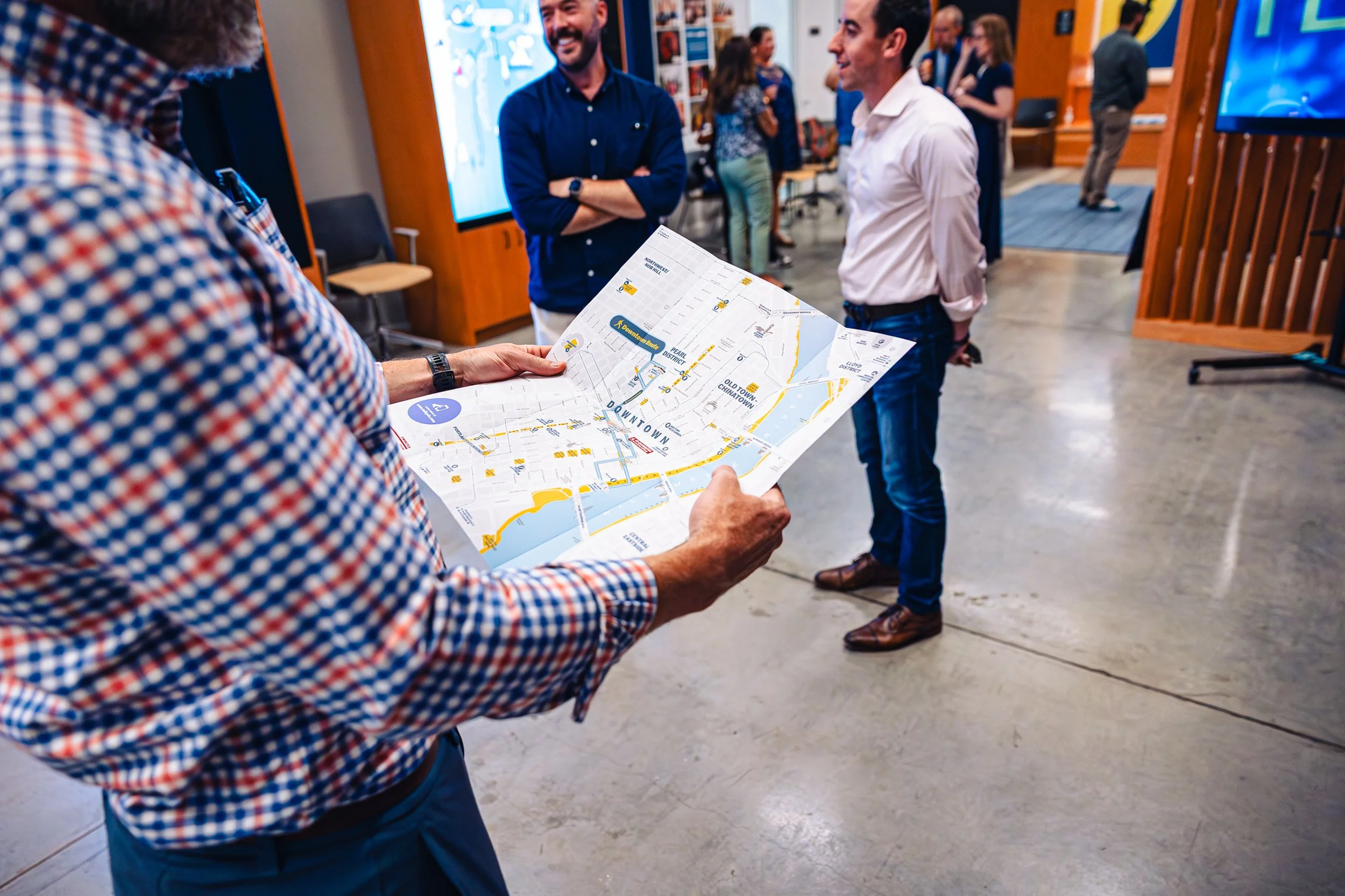
We created a range of sign types and deployed them along a route through Downtown Portland, linking key destinations.


Many of the signs mounted to existing infrastructure to help reduce cost.

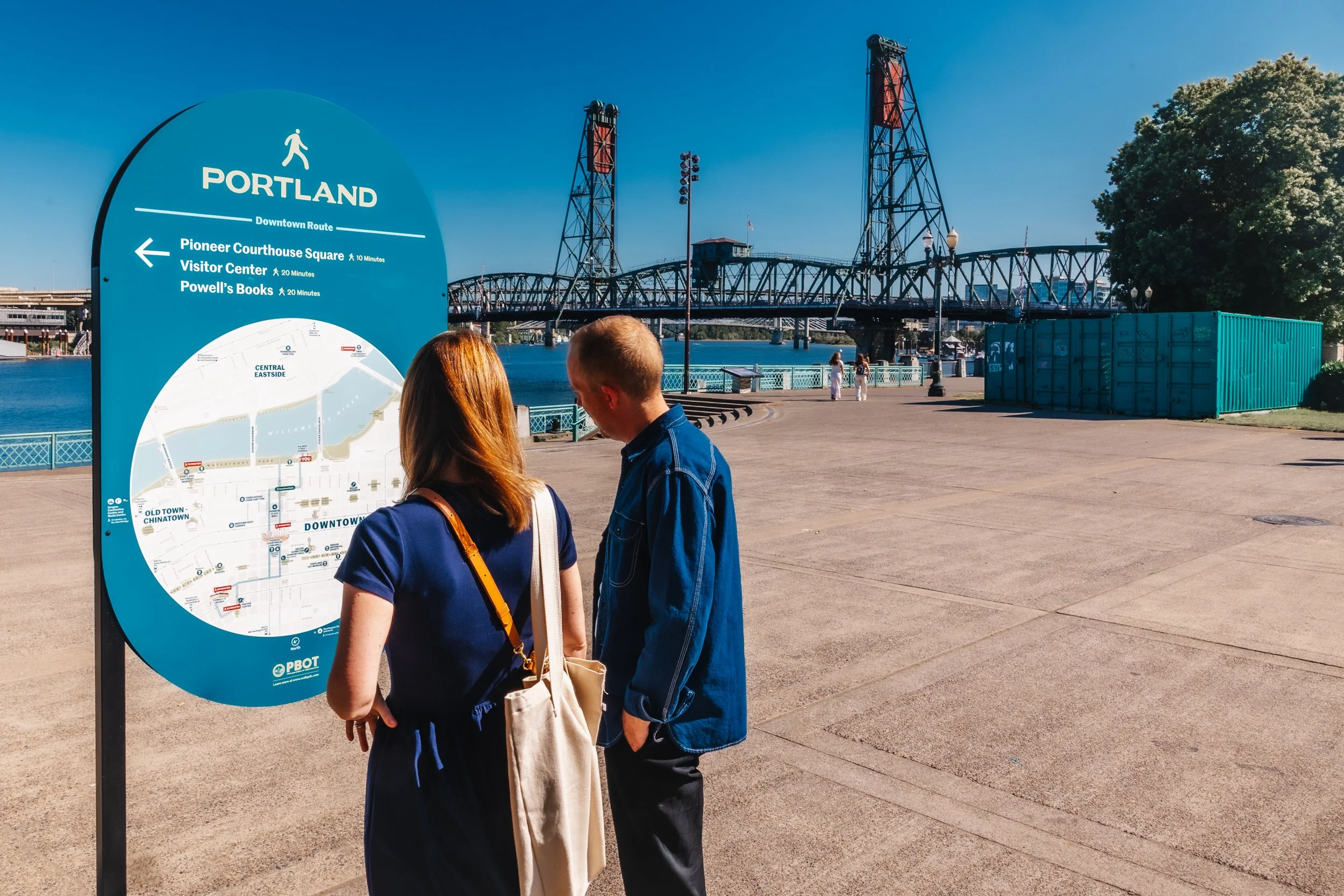
The pilot explored marking a route that linked Powell's Books (the top tourist destination), Pioneer Courthouse Square and the waterfront.

We tested a range of sign types to gauge their effectiveness.

Maps and signs at transit stations helped people orient themselves after disembarking MAX trains and street cars.
Visitor center staff worked with us to test the effectiveness of the system.


Our client team led dozens of tours to share the project and gather feedback. QR codes on the signs led to a survey and captured data about the effectiveness of the signage.
The pilot phase ended in Autumn, 2025. We’re currently gathering our findings and preparing to implement a permanent system.
We are indebted to our uniquely collaborative partners at Travel Portland and PBOT for helping bring this project to life.
Award Recognition
Society for Experiential Graphic Design (SEGD)
Global Design Awards: Honor Award and Sustainability Impact Recognition